Reading the Earth’s Memory — Paleoseismology and Earthquake History
Reading the Earth’s Memory: Paleoseismology and Earthquake History
Отрывок для чтения
When the ground shakes, it leaves marks — not just in broken buildings, but in the earth itself. Geologists have developed a discipline called paleoseismology, the study of ancient earthquakes using the evidence preserved in geological layers, to reconstruct thousands of years of seismic history. This science is quietly saving lives by revealing patterns that written human records are too short to capture.
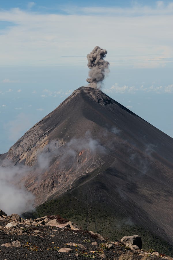
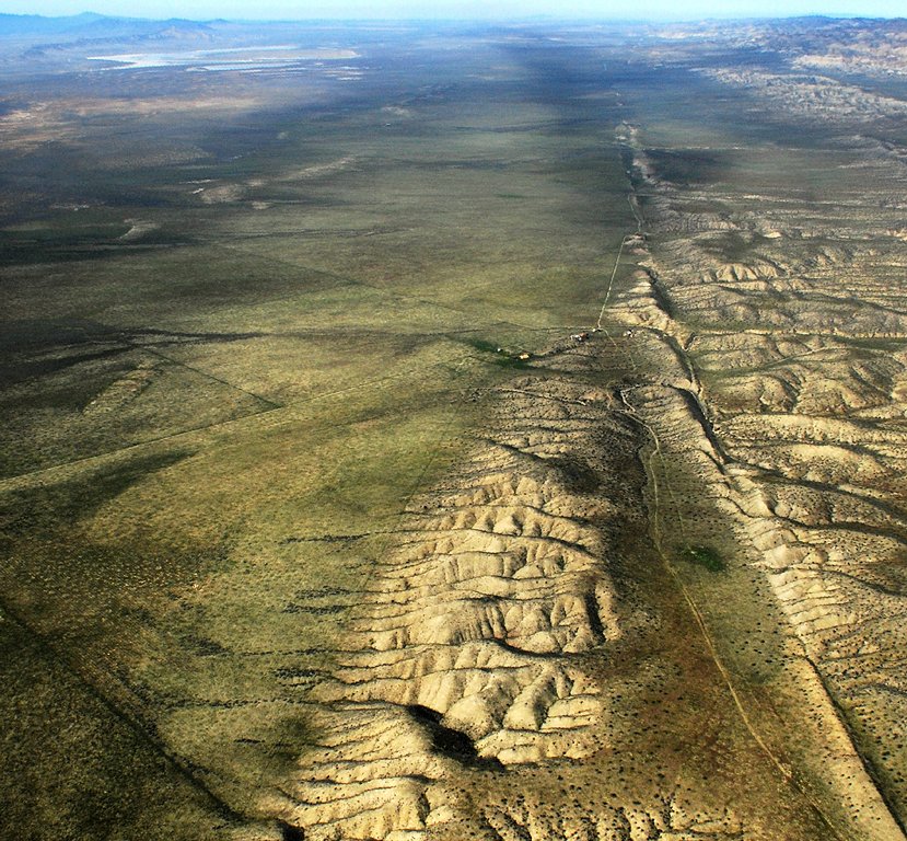
The surface of the Earth is divided into massive sections called tectonic plates. These plates move slowly, driven by heat flowing from the Earth’s interior. Where plates meet, stress accumulates along fractures in the crust called fault systems. When accumulated stress is suddenly released, the ground ruptures and shakes — this is an earthquake. The point on the surface directly above the earthquake’s origin is the epicenter, and the strength of shaking is expressed as magnitude, typically measured on the moment magnitude scale.
Most of what people know about earthquakes comes from historical records: written accounts, instrumental measurements, and eyewitness testimony. But this record extends back only a few centuries in most parts of the world — and even less in many regions. Tectonic plates accumulate stress over hundreds or thousands of years. A fault that was quiet during the entire recorded history of a civilization might still be capable of a catastrophic rupture.
Paleoseismology addresses this limitation by treating the Earth’s layers like pages in a book. When an earthquake causes a surface rupture — a crack that breaks through to the ground surface — it displaces the layers of sediment or rock on either side. Subsequent layers of sediment then cover this displacement, preserving a record of when the rupture occurred. By excavating trenches across fault lines and analyzing the stratigraphy — the arrangement and composition of rock and sediment layers — scientists can identify and date past earthquakes with considerable precision.
The dating process often relies on radiocarbon analysis of organic material such as charcoal or plant fragments found within the disturbed layers. Each earthquake event appears as a distinct stratigraphic marker. The recurrence interval — the average amount of time between major earthquakes on a given fault — can then be calculated from multiple events. This allows scientists to estimate the probability that a major earthquake will occur within a specific future time window.
A six-year collaborative study of a 150-mile fault system in Nepal identified between 3 and 14 previously unknown major earthquakes that occurred within the past 10,000 years. Nepal sits on the collision boundary between the Indian and Eurasian tectonic plates — one of the most seismically active regions on Earth. The 2015 Gorkha earthquake, which killed nearly 9,000 people, was a sobering reminder of this region’s destructive potential. Paleoseismic data from the Nepal study is now being used to refine seismic hazard maps, which inform building codes and infrastructure planning.
In Myanmar, paleoseismic analysis of the fault system responsible for the devastating March 2025 M7.8 earthquake revealed evidence of at least five previous surface-rupturing earthquakes within the past millennium. Although satellite imagery and modern seismometers can locate and measure contemporary earthquakes, only paleoseismology can extend the record far enough back to identify true recurrence patterns.
The practical applications of this research are substantial. Earthquake-resistant building design requires knowing not just the maximum expected magnitude, but also the likely frequency of large events. Liquefaction — the process by which saturated soils temporarily behave like a liquid during intense shaking, causing structures to sink or collapse — is particularly dangerous in delta regions and river valleys. Paleoseismic data can identify which areas have experienced liquefaction in the past and are therefore likely to experience it again.
Paleoseismology does not predict individual earthquakes. No scientific method can yet determine exactly when the next earthquake will strike. What this science does provide is a statistically grounded picture of seismic hazard — the probability and likely intensity of future shaking based on the geological record. In regions where that record has been hidden under centuries of sediment, paleoseismologists are its archaeologists.
Словарный запас
- Paleoseismology — the scientific study of ancient earthquakes using evidence preserved in geological layers, used to reconstruct earthquake history beyond written records
- Fault system — a network of fractures in the Earth’s crust along which rock masses move; a major source of earthquake activity
- Surface rupture — the visible cracking or displacement of the ground surface during a large earthquake, which creates a preserved record in sediment layers
- Seismic hazard — the probability and expected intensity of earthquake shaking in a given location, used to guide building codes and land-use planning
- Tectonic plates — large, rigid sections of the Earth’s outer crust and upper mantle that move slowly over geological time, interacting at their boundaries to produce earthquakes and volcanoes
- Stratigraphy — the study of rock and sediment layers (strata), including their composition, sequence, and age; used in paleoseismology to date past earthquakes
- Recurrence interval — the average amount of time between major earthquakes on a specific fault, calculated from the paleoseismic record
- Magnitude — a measure of the energy released by an earthquake; each whole number increase represents approximately 31.6 times more energy released
- Epicenter — the point on the Earth’s surface directly above the underground origin of an earthquake
- Liquefaction — a process in which water-saturated soil loses its structural strength during intense earthquake shaking and temporarily behaves like a liquid, causing buildings to sink or tilt
Вопросы на понимание текста
1. What is paleoseismology, and why is it necessary? (Short answer)
2. What causes earthquakes according to the passage?
- A) Changes in atmospheric pressure pushing down on the Earth’s crust
- B) Volcanic eruptions releasing magma beneath fault systems
- C) Stress accumulated along fault systems being suddenly released
- D) The collision of meteorites with the Earth’s surface
3. What is a surface rupture, and why is it important for paleoseismologists? (Short answer)
4. How do scientists determine the age of past earthquakes in the sediment record?
- A) By measuring the thickness of sediment layers deposited each year
- B) By using radiocarbon analysis of organic material found in disturbed layers
- C) By studying satellite photographs of earthquake damage
- D) By comparing historical written records with modern seismometer data
5. What does the term “recurrence interval” mean?
- A) The time it takes for a building to collapse during an earthquake
- B) The average time between major earthquakes on a specific fault
- C) The frequency at which seismometers record minor tremors
- D) The period of aftershocks following a major earthquake
6. How many previously unknown major earthquakes did the Nepal study identify over the past 10,000 years? (Short answer)
7. What did paleoseismic analysis reveal about the fault system in Myanmar?
- A) The fault had been inactive for more than 2,000 years
- B) The 2025 earthquake was unprecedented in the geological record
- C) At least five surface-rupturing earthquakes had occurred in the past millennium
- D) Liquefaction was the primary cause of building damage
8. What is liquefaction, and why is it especially dangerous in delta regions? (Short answer)
9. Which of the following does paleoseismology NOT provide?
- A) Information about the recurrence interval of major earthquakes
- B) A precise prediction of when the next earthquake will strike
- C) Evidence of past surface ruptures preserved in sediment layers
- D) Data used to improve building codes and seismic hazard maps
10. Where is Nepal located in terms of tectonic plate boundaries, and why does this make the region seismically active? (Short answer)
Critical Thinking
- The passage compares geological strata to “pages in a book.” Explain this metaphor in your own words. What kind of information is recorded in these “pages,” and what are the limitations of this record compared to written historical records?
- Paleoseismology cannot predict when the next earthquake will strike. Does this limit its value as a science? Explain how probabilistic hazard information — knowing how likely an earthquake is, rather than exactly when — can still be useful for governments and engineers.
- The Nepal fault study took six years and required international collaboration. What challenges do you think researchers faced in conducting this study? Consider both scientific and practical factors.
- Countries like Nepal and Myanmar are economically developing regions with limited resources for infrastructure improvements. How should governments prioritize seismic risk reduction when construction budgets are limited? Who is most at risk, and why?
- The 2015 Gorkha earthquake in Nepal killed nearly 9,000 people. Japan experiences earthquakes of similar or greater magnitude but typically has far fewer casualties. What factors — beyond the size of the earthquake — determine how deadly an earthquake event will be?
Fill in the Blank
- Scientists use ______ — the study of rock and sediment layers — to identify and date the surface ruptures left behind by ancient earthquakes.
- The point on the Earth’s surface directly above the underground origin of an earthquake is called the ______.
- In water-saturated soils, intense earthquake shaking can trigger a process called ______, causing the ground to temporarily behave like a liquid and buildings to sink or collapse.
Extended Response
Prompt 1: Explain how paleoseismology extends our understanding of earthquake hazards beyond what historical written records and modern instruments alone can provide. In your response, describe the specific methods used by paleoseismologists, and discuss how this information is applied to protect human lives. Use at least three vocabulary terms from this worksheet.
Prompt 2: The passage states that paleoseismologists are “archaeologists” of the Earth’s seismic record. Using this analogy, write an essay comparing paleoseismology to archaeology. In what ways are the two disciplines similar in their methods and goals? How does each field use physical traces preserved over time to reconstruct past events, and why does this kind of historical reconstruction matter for the present?